
Proceedings of the Nineth International Conference on Learning Representations (ICLR 26) · 2026
GeoDiv - Framework for Measuring Geographical Diversity in Text-to-Image Models
Why this publication matters
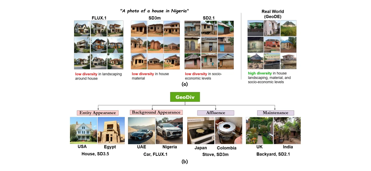
A model may generate a narrow stereotype when asked to show everyday life in a particular country. GeoDiv separates different aspects of that problem, including visual variety and socioeconomic portrayal. It gives researchers a more informative way to measure whose experiences are represented in generated images.
Abstract
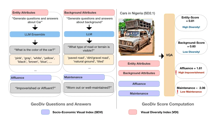
Text-to-image (T2I) models are rapidly gaining popularity, yet their outputs often lack geographical diversity, reinforce stereotypes, and misrepresent regions. Given their broad reach, it is critical to rigorously evaluate how these models portray the world. Existing diversity metrics either rely on curated datasets or focus on surfacelevel visual similarity, limiting interpretability. We introduce GeoDiv, a framework leveraging large language and vision-language models to assess geographical diversity along two complementary axes: the Socio-Economic Visual Index (SEVI), capturing economic and condition-related cues, and the Visual Diversity Index (VDI), measuring variation in primary entities and backgrounds. Applied to images generated by models such as Stable Diffusion and FLUX.1-dev across 10 entities and 16 countries, GeoDiv reveals a consistent lack of diversity and identifies finegrained attributes where models default to biased portrayals. Strikingly, depictions of countries like India, Nigeria, and Colombia are disproportionately impoverished and worn, reflecting underlying socio-economic biases. These results highlight the need for greater geographical nuance in generative models. GeoDiv provides the first systematic, interpretable framework for measuring such biases, marking a step toward fairer and more inclusive generative systems. Project page: https://abhipsabasu.github.io/geodiv
Figures
Cite this paper
@inproceedings{basu2026geodivframeworkfor79,
  title = {{GeoDiv - Framework for Measuring Geographical Diversity in Text-to-Image Models}},
  author = {Abhipsa Basu and Mohana Singh and Shashank Agnihotri and Margret Keuper and Venkatesh Babu Radhakrishnan},
  booktitle = {International Conference on Learning Representations},
  year = {2026},
  url = {https://openreview.net/forum?id=WliHWqTfAb}
}
Figures and abstract are reproduced from the linked research sources. Credit remains with the authors and publishers.